
Kaiaua to Kopu Cycle Trail – Waitakaruru to Pipiroa
The K2K cycleway is a joint venture between the Thames-Coromandel and the Hauraki District Council to connect the K2K with the original Thames to Te Aroha rail trail, a section of the larger Hauraki Rail Trail network.

The Friday morning I drove down to the K2K cycleway I had intended to enter the trail at Miranda as it’s the closest open entry point from Auckland due to the Kaiaua to Miranda section still being under construction however, I could not for the life of me find the entrance of the trail. Thankfully I had seen a photo (see below) on Facebook which showed Sculpted Metal in Waitakaruru in the background so I figured that I’d head to that point and enter the K2K there.

Entrance at Waitakaruru (Sculpted Metal in the background)
Upon my arrival in Waitakaruru I couldn’t actually see any signage but I did see a trail entrance and after driving further than I’d expected, that was good enough for me.
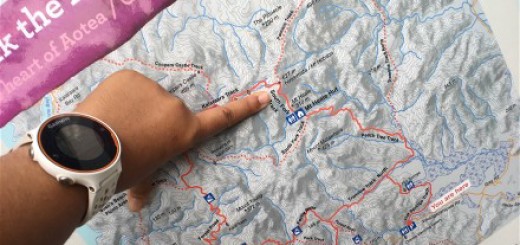
The 1km trail markers aren’t as clear as the ones I’d seen between Paeroa and Waihi on the Hauraki Rail Trail but after a kilometre or so I figured out that I was heading towards Kopu (eg in the opposite direction of Miranda). No biggie, I’d planned to return to ride this section at a later date anyway, so now was a good as time as any.
The trail is wide (you could easily fit four cyclists next to each other) freshly laid gravel trail that apart from one very short mound (I say mound as I wouldn’t call the incline a true hill) is completely flat. The gravel is still quite thick and it’s quite hard going if you cycle up the middle. I found it easier to follow what looked to be vehicle tyre tracks on the edge of the trail, which at a guess where made by farm vehicles as the trail splits farming land (complete with grazing stock) and the saltmarsh.

K2K Cycleway
I’m not sure at what point you have officially reached Pipiroa as there is no signage but my best guess would be once you reach the clip-on cycle lane on the Piako River bridge which allows cyclists to cross the river separately from traffic on SH25.
One thing to note is to get to this point, you need to travel approximately 2km along a road. It is a quiet road, but one that has several homes and a farm on it and on the Friday morning I rode along it there were a few cars traveling along it at the same time. It looks like they may be extending the trail along the bank above the road, but at this point in time traveling along the road is your only option.

The Pipiroa Bridge
Also, on the other side of State Highway 25 is a cafe’ so it’s a great place for a break before turning around and heading back or a lunchstop if you’re going all the way through to Kopu. I can’t comment on the food or facilities as I chose to venture further along the trail and ended up stopping in the middle of the next section for a bite to eat, but I’ll write about that section in a separate post.
For more information check out the Hauraki Rail Trail website.
Till next time