
Fairy Falls Track, Cascade Kauri Regional Park
From Scenic Drive, opposite the parking area, the initial section of track is level and gravelled but later descends steeply to the top of Fairy Falls (45 minutes). Track then makes an extremely steep descent partly down a boardwalk, beside the falls and continues downstream a short way before a gradual ascent to Mountain Road. 3.2km – 1 hour 30 minutes. (Source).

Unlike when I arrived at the Okura Walkway to find out that there were over 670 stairs on the track, this one (as it’s popular enough to easily find a tonne of information online about it) I knew prior to traversing it that there were a lot of stairs, which is one of the main reasons I hadn’t been at all interested in running it and it was a spur of the moment decision that found me at the start of the track one Friday afternoon in July.
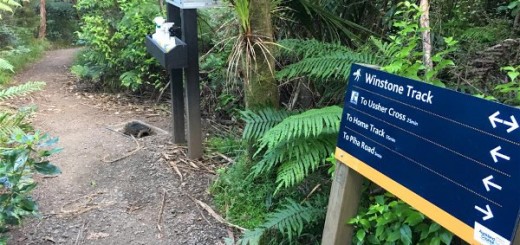
From the car park on Scenic Drive the path runs parallel with the road for about 20 metres, passes the only toilet facility available in the area (stop now if you need “to go”) and then veers right towards the junction at the shoe cleaning station. Old Coach Road Track is on the left and Fairy Falls Track continues straight ahead.
The first section is relatively flat, wide and firm underfoot, it then gradually descends and narrows towards the Upper Falls (passing Goodfellow Track on your left). Once you reach the Upper Falls, where a handrail has been installed to help you cross over the top, the track then ascends very steeply via lots (and lots) of stairs down to the Lower Falls.

The first time I ran this track I got a little lost at this point, I knew that the track was supposed to end at Mountain Road, so it obviously continued somewhere, but it’s not entirely obvious. I made my best guess and walked across the wet (and slippery in places) rock towards a small cave like structure on the other side (which kind of looked track like) and as I got closer I saw the orange triangle that confirmed I was in the correct place. I carried along this “path” (in the loosest of loose sense of the word) until I came to a water crossing with an obvious track on the other side.
There was a pile of wood here too – so they may be about to build a bridge at this point.

The track from the falls towards Mountain Road was (in July 2016) being upgraded so there were large mounds of scoria and earth moving equipment along the route BUT that being said, this entire section of track is really nice to run along, there are even views across the valley, which is a nice change from the top section which is very enclosed.
The track ends at the Mountain Road car park (which is a third of the size of the one on Scenic Drive, you could probably fit 5 cars comfortably).
My tips;
- I’ve now run the track from both ends and in my opinion it’s a much easier run if you start and end at Mountain Road, mostly because you won’t have to ascend a tonne of stairs right at the end.
- If you have kids in tow and are just going as far as the Falls, I’d suggest you start at Mountain Road. Although it’s only a slightly shorter walk, it’s a much easier one (especially on little legs) as they won’t have to navigate the stairs, they will however have to traverse two water crossings although neither are very deep and both are quite narrow.
- This is another track that is usually crazy busy and the section down to the falls can be quite tricky for the smaller (older or less fit) among us, so just chill and enjoy the view.
Till next time

For more photos check out the Photo Albums