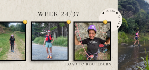

Pukematekeo Track – Cascade Kauri Regional Park
Every time I venture into the Cascade Kauri Regional Park, I have to drive past the entrance to the Pukematekeo Track to get the carparking area. I had intended to venture up the hill during summer with the kids in tow (as it’s quite a short track), however we never got around to it and due to the fact it climbs up to the Mt Pukematekeo look out on Scenic Drive, I haven’t been too keen on attempting it in Winter.
Tramping Track –
From the bend on Pukematekeo exit road, 70m below trig, the track follows the ridge with a steep final descent to Falls Road.
1.6km 45 min (Source)
So I’m not sure why one Wednesday afternoon instead of hitting the trails at the car park end of the park, I headed back up the driveway to Pukematekeo.

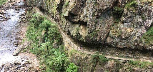
The entrance of the track is directly opposite the Rangers Station and as expected (in the winter) it’s a steep and slippery climb. Although in my opinion a much easier climb than the Houghton Track as the path underfoot wasn’t deeply grooved clay. This track even has random steps placed along the way (which I found to be a godsend on the descent). It is however, pretty root infested therefore it’s not an easy trail to navigate, let alone run .. (not that I’m a hugely proficient hill runner) and I lost count of the number of trees that have fallen across the track that you have to clamber over.
I will mention because of the way the tracks winds through the trees it’s quite hard to tell how high up the mountain you are and there were only a couple of places along the way where you could peek out over the valley below. I didn’t realise until I ended up among the clouds! I guess that’s the one positive of climbing up a big arse hill on an overcast and rainy winters afternoon.

The track “proper” finishes near the top of the driveway to the Mt Pukematekeo look out which you can reach if you turn right and either follow the driveway to the end or follow the pathway on the right hand side a short way up the hill from where this track ended and continue across the bridge (it’s not signposted, you will only see two white posts). The distance to the look out is approximately 250 metres (making the total distance to from the start 1.85 km).

The ascent took 33 minutes but it took an extra 10 minutes to descend (or should I say slide down the hill) and although the “steep descent to Falls Road” didn’t seem that steep when I ascended it, the angle of the slope is very noticeable (and the track extraordinarily narrow) on the way back down.
My tip for this track ..

Don’t wear white 😉
Till next time

For more photos please check out the photo albums.