
Karamatura Loop Walk – Huia Regional Park
A great way to spend an hour in the valley, the Karamatura Loop Walk has a good track surface and reasonable gradients making it a suitable walk for families during most seasons. It is recommended that this circular walk be done in an anti-clockwise direction, 2.4km. (Source).
I couldn’t quite decide what to make of the Karamatura Loop Walk ..
I’d say that it’s supposed to be on par with Cascade Kauri’s Auckland City Walk, after all they are probably aimed at the same demographic and although the Rangers Stations is right next door (as in the very next driveway) it seems very – well, quite frankly – unloved.
There are a tonne of signs missing (although perhaps I shouldn’t assume that once upon a time there were signs posted where I imagined there should be one) – for example, the description above (from the ARC website) recommends that this circular walk be done in an anti-clockwise direction – however if this was the first time you’ve ever been in the area you would have no choice but to do it that way as there is no signage on what turned out to be the “loop” section of the Karamatura Loop.
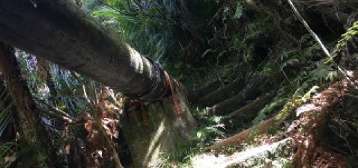
Also I ran past a random large stump on a tram type thing. I’m guessing there used to be a information board near here to tell you what this was/is, but I couldn’t see anything – If I was to hazard a guess this is how they used to get the felled trees from up on the hill, down the bank. But yeah, like I said, I’d just be guessing.

What you will however find (in abundance) is Hillary Trail markers – perhaps that’s just in case half of them get stolen, at least you’d still be able to find your way with the other half that remain. By the way – I’m only “half” joking – those Hillary Trail signs get pinched all the time! Don’t be so cheap and go to the Visitor Centre and buy a momento – or take a photo ..
Anyhoo, back to the issue at hand – The Karamatura Loop Walk (or run as the case may be).
From the large car parking area on Huia Road the trails start on the other side of the large information board. The Karamatura Loop Walk starts as narrow gravel pathway that veers left up the hill and then turns right to go through the centre of wide open field. On the other side of the field you head into the forest and reach the shoe cleaning station a short time later. At this point the trail is a wide gravel pathway that follows the stream (although you can’t see it through the vegetation).
After a couple of minutes you’ll cross a bridge and pass by the pretty gnarly looking Fletcher track on your left and approximately 200m later you’ll reach another path on your left (which was unmarked at the time I went). This happens to be the “loop” part of the Karamatura Loop, so you could – should you wish too head up that track, but as I had no idea where I was I went straight ahead.
The trail is quite damp, which is quite usual for trails that follow stream beds and narrows the further along you get. Although you can tell that you are ascending a hill, the trail undulates just enough to make the vast majority of it runnable, even when you’re as shit at running up hills as I am and you’ll reach the signposted turning point for the loop in approximately 10 minutes.
This section is much narrower and is far more overgrown that the lower level but the added height affords much better views across the valley, there is even a lookout platform. The platform is intricately marked with the number 8, so perhaps it’s going to be included in the Orienteering Course that is currently under construction – although like the tram and stump earlier, I’m just guessing.

From the look out, you follow a ridge for a short while and as then as they saying goes, what goes up, must come down and in this case via lots of stairs #sigh. After approximately 10 minutes you find yourself at the bottom of the unmarked trail that you passed earlier. Turn right to head back to the car park. I will mention that instead of going straight ahead you can turn left just after the shoe cleaning station and follow the Hillary Trail marked sign. This trail is mostly used by people to reach the Karamatura Campsite on the other side of the stream but it does lead back to the car park (and perhaps more importantly passes the toilet facilities, which incidentally are some of the nastiest I’ve ever had the “pleasure” of using). The toilet facilities at Cascade Kauri beat these ones hands down!
The other stuff;
Location – 1320 Huia Road – If you get to the Ranger Station or Museum you’ve gone too far.
Parking – Yes (large).
Toilets – Yes.
Kid Friendly – Yep! But honestly? If you live closer to Cascade Kauri, take them to the Auckland City Walk.
Till next time